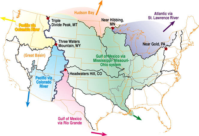
"Major" Triple Divides in the Continental U.S.
I downloaded the major watershed boundaries on this map (black and
gray lines) from the US Dept. of Agriculture website. I then shaded
in the different watersheds for the interior of the continental U.S.
The points where three colors meet (indicated with red dots) are what
I consider to be "major" triple divides. The purple line is the
Continental Divide, and the yellow line is the so-called "North-South
Divide".
