| |
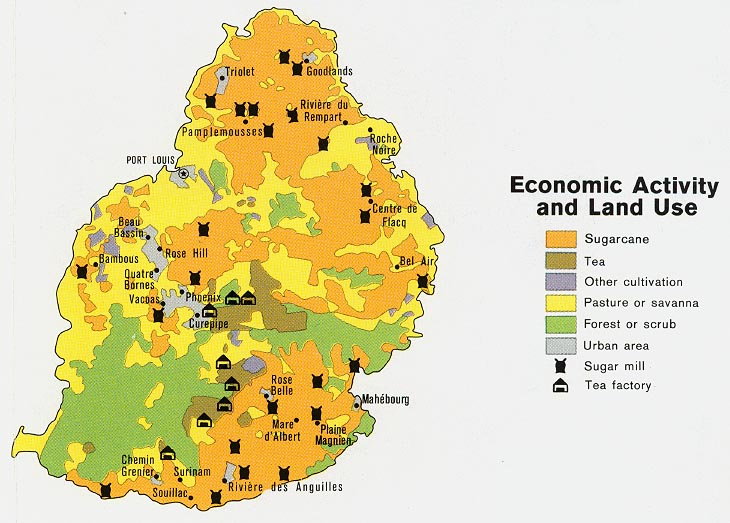
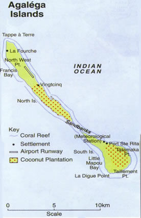
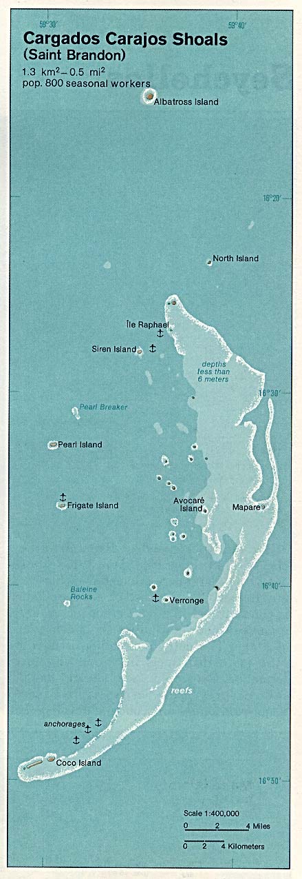
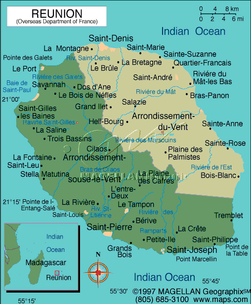
It shows where the Mascarene Islands are located. On peut voir l'emplacement des Iles Mascareignes a l'est de l'Afrique Location of Mauritius - Emplacement de l'Ile Maurice General Map of the region around Mauritius Mauritius map in English Carte de I'ile Maurice en Francais Mauritius Map of Economic Activity and Land Use North Map of Mauritius - Carte du Nord de l'ile Maurice Ile d'Ambre Cette carte est en francais Ile aux Cerfs Vous pouvez voir les iles Lubines, Ile Forency, Ile de L'Est, Ilot Mangenie Island Dependencies of Mauritius - Les dépendances de MauriceAgalega ArchipelagoSouth Island and North Island - Les iles Du Nord et du Sud Agalega Archipelago Map in english with a legend - Carte avec une légende en anglais Ile Tromelin Map in english, You can see the airstrip - Carte en anglais on peut voir l'aéroport The Chagos Archipelago We can also see the Three Brothers, Danger, Nelsons, Egmont, Peros Banhos, Garcia, Salomon and Eagle Islands Chagos Excellent Map with the shoals, banks and islands - On peut aussi voir les ilots. Carte trčs detaillée Diego Garcia Map in English Diego GARCIA Navigation map depth charth- Carte Maritime profondeur de l'eau est indiquée Diego Garcia Another navigation map in English Peros Banhos Navigation Map Pero Banhos With the names of the islands Salomon Island - Ile Salomon Cargados and Carajos Shoals (St-Brandon) Carte routičre de Rodrigues Reunion Carte en francais, routičre detaillée - Very detailed map of the island (in French) Simple Réunion Map in English (Lonely Planet) Réunion with main sites and beaches Réunion, good map Overseas Department of France Réunion - Carte Interactive Carte de Rodrigue Villes seulement Rodrigues Island English Map Ile Rodrigues Carte routičre avec les villes les plus importantes seulement See AlsoCook Islands mapsMarquesas Islands - Les Iles Marquises Maps of Hawaii Maps of New Caledonia - Cartes des iles de la Nouvelle-Caledonie Cartes des Iles Maurices - Mauritius maps Cara das Islas Malvinas - Maps of the Falkland Islands |
||