(Sothern Iran)
by
Tirdâd Gorgâni
Abu Musâ Islands
Kiš Island
Qešm Island
Tonb Islands

The weather of the city is warm and humid and is under the influence of arid and semi-arid climate
Jâsk is a comparatively thriving region and resembles a peninsula that is surrounded by water on the three sides, enhanced by a tranquil and beautiful coastal area.
Events
Iranian Calender
Traditional Iranian Martial Sport
Language
Persian Gulf
Persian Myths
Maps
Province: Hormozgân, Southern Irân
Population: c. 50,000
Language: Persian and local dialects
Transportation: Coaches from Minâb and Bandare Abâs
Accomodation: There is a budget hotel in Jâsk.
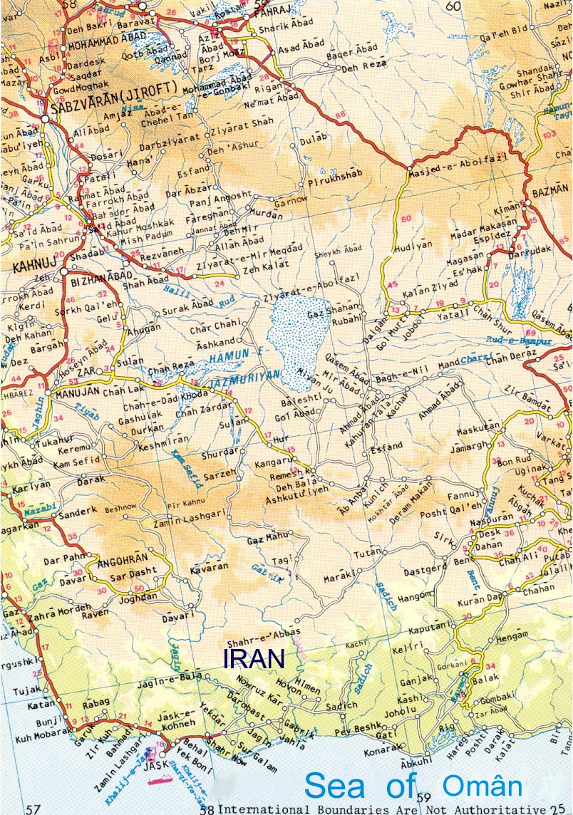
City Map: Click here

Mithraism
The House of Power
Weather
Wine among Persians
Hormozgan Province
Iran's Coastal Wetlands

The Faith of Mithraism
For over three hundred years the rulers of the Roman Empire worshipped the god Mithras. Known throughout Europe and Asia by the names Mithra, Mitra, Meitros, Mihr, Mehr, and Meher, the veneration of this god began some 4000 years ago in Persia.
The faith spread east through India to China, and reached west throughout the entire length of the Roman frontier; from Scotland to the Sahara Desert, and from Spain to the Black Sea. Sites of Mithraic worship have been found in Britain, Italy, Romania, Germany, Hungary, Bulgaria, Persia, Armenia, Israel, Syria and North Africa.
More About
* The shrine of “Emâmzâde Amir Divân” is worth seeing.
* The beautiful and calm shores of the peninsula. It is an unforgettable experience to take a few hours to wander to its beauty.


You can see how fishermen catch fishes with traditional equipments and boats, by doing a daily trip to the traditional fishing villages of Behal and Yekboni. These villages are just a few kilometers south eastern Jâsk. See map.
Getting there: The easiest way is to charter a car/Taxi from Jâsk.
Area 11,500 ha
Geographical Coordinates 25°15'N 57°40'E
Location A few kilometres north of fishing port of Jâsk, southern Iran.
Principal Features A large tidal creek (Xore Jâsk) and adjacent mudflats, beaches, dunes and sparsely vegetaded sandy plains.
The creeks extends several kilometres inland and contains a particulary fine stand (c.100 ha) of mangrove Avecinna marina at its far end. See map.
The site is extremely important for wintering waterfowls, shorebirds and gulls such as Pelecanus crispus, Ardea goliath, Ardeola grayii, Burhinus recurvirostris Haliaeetus albicilla etc. Pterocles exustus and Calandrella raytal occur on the plain.More about
Getting there: The easiest way is to charter a car/Taxi from Jâsk.


Area 14,000 ha
Geographical Coordinates 25°35'N 58°20'E
Location 45-80 kilometres east of Jâsk, southern Iran.
Principal Features The site covers c.35 km of See of Oman coast, comprising an extensive complex of tidal creeks, mudflats, mangrove, sandbanks and low muddy offshore islands and sandbars. The rivers (Rud means river in Persian) flow only after erratic rainfall in the interior, usually in winter. Extensive stands of mangrove Avecinna marina occur at the river mouths and along tidal creeks. The adjacent arid plain supports a relatively dense woodland of Acacia, Prosopis and Ziziphus interspersed with bare sandflats. Stands of tall Tamarix forest line the river banks. The area is remote, with only a few tiny fishing villages nearby. See map.
The site is extremely important for wintering waterfowls, shorebirds, terns and gulls, with smaller number of Pelecanus crispus, Platalea leucorodia and Phoenicopterus rubber.
Ardeola grayii is probably resident in the mangrove. The sand plains and woodland support a typical local avifauna including Francolinus pondicerianus and Dendrocopos assimilis. Accipiter badius, Streptopelia orientalis, Saxicola caprata and Sylvia nana have been recorded here in autum. More about
Getting there: The easiest way is to charter a car/Taxi from Jâsk.
The East India Company was established here in the year 1619 AD.
In late 1620 AD. the Portuguese halted the entrance of two ships of the East India Company from docking in the port of Jask. Thus evoking a severe battle between the British government and the Portuguese, which resulted in the defeat of the latter.
Between 1857-1868, The Indo-European telegraph lines and undersea cable which connected Iran to Europe and India was established here.
Today Bandare Jâsk is a comparatively thriving region and resembles a peninsula enhanced by a tranquil and beautiful coastal area.
