 |
| 1619 map showing Philip Lane - Note orientation of Map South to North |
PHILIP LANE N15 |
Philip Lane has long been established as one of the Major roads in Tottenham and has featured on many old maps of the borough. It served as the route between Tottenham High Cross and the West Green and onwards to Ducketts Green in Hornsey. For centuries this had been just a rural lane bordered by agricultural fields until the area began to be developed in the mid 19th Century. In 1851 there were 36 acres of meadow offered for building on the land between Philip Lane and West Green Road. The two roads were connected by Summerhill Road, where terraces had been built in 1856 and 1859, and by Bathhurst (later Lawrence Road), which contained a floor cloth factory. These roads were dissected by the new Clyde Road, where new terraced housing had also been constructed in the early 1850's.
 |
| 1619 map showing Philip Lane - Note orientation of Map South to North |
It was interesting to note that in 1851 Philip Lane was referred to as West Green Lane, and indeed the Ordnance Survey map from 1848 also shows it as West Green Lane. We can only assume that for a brief period in its history Philip Lane was for some reason renamed. The Auction notice offers 36 acres of Meadow land for development between West Green Lane and West Green Road.
 |
 |
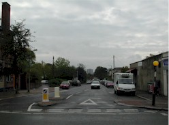
We are indebted to Mike Diprose, a former resident of Summerhill Road, who on a recent visit to see his former home, took some interesting photographs of Philip Lane at its junction with Summerhill Road. We have reproduced some of Mike's photographs and where possible have shown some old photographs to help give a THEN and NOW perspective.
 |
 |
St Philips Church -1911 |
St Philips Church 2007 |
 |
 |
Parade of Shops East of Lord Palmerston 1913 (looking West) |
Parade(Obscured) looking East from Lord Palmerston 2007 |
 |
 |
Philip Lane from Downhills Park Rd 1920 |
Philip Lane from Downhills Park Rd 2007 |
 |
 |
Philip Lane looking West from Downhills Park -1908 |
Downhills Park Road 2007- Note old Bank Building |
To help provide a further perspective of Philip Lane we have collected some more archive images and interspersed some of Mike Diprose's recent photographs.
 |
 |
 |
Holy Trinity Church 1894 |
The Swan -High Cross 1890 | The Greyhound-Philip Lane-1908 |
 |
 |
 |
The Lord Palmerston 2007 |
Junction Summerhill Road 2007 | Shops West of Summerhill Road 2007 |
 |
 |
 |
| Philip Lane - Clonmel Road - 2007 | Philip Lane -Mansfield Road- 1930's? | Philip Lane-Mount Pleasant Rd- 1908 |
 |
 |
 |
| Downhills Junior School | Downhills School Crossing 1951 | Downhills Church Hall |
By way of the authors licence, the above photograph of the Downhills School Crossing. which I believe must have been taken in 1951/2, actually shows me(Alan Swain) and my brother Ray and my sister Christine returning home from school. Also in the picture is Stewart Green (walking alongside the pram).
Obviously our powers of observation were not so good when we were kids walking along Philip Lane, as Mike Diprose has taken photographs of some of the architectural features on the buildings in Philip Lane, which on my part I cannot recall ever noticing all those years ago. The large ornate looking plaque on the building at the corner of Summerhill Road is of particular interest. I must have passed that building on thousands of occasions but cannot recollect ever having seen it before.
 |
 |
 |
 |
Many of the older residents of Philip Lane and Summerhill Road will recall that the 'HOVIS' sign was once 'Browns Bakeries',(Mr Brown lived at number 23a Summerhill Road) and you would often call in on the way to school to buy stale cakes which were left over from the previous days bake. In those post-war years it was certainly a case of 'Waste not-Want not'. The 'Off Licence' was once called 'Berridges' and I can recall that you had to take a step down into the shop from the pavement outside. In days of heavy rain the water would often run down into the shop and cause minor flooding.
One of the more famous residents of Philip Lane was Dave Clark from the 'Dave Clark Five' a very successful pop group from the 1960's. Dave Clark lived with his parents above the 'Williams Brothers' grocery store in Philip Lane. It was situated on the corner of Kitchener Road and almost immediately opposite the 'Greyhound' Public house, although the pub had since been renamed as the 'Botany Bay'.
Philip Lane is also the location for Tottenham Bus garage, and the following photograph dating from 1911 shows the garage from its days when owned by the M.E.T Transport company prior to being absorbed within London Transport. Philip Lane was also the route for the 171 Bus that used to run between Bruce Grove and West Norwood. This was the first bus service to run along Philip Lane and, at the time of its introduction in the 1950's, was one of the longest routes operating on the London Transport system.
|
 |
Tottenham Garage -Philip Lane 1911 |
London Transport -171 Bus |
Clearly we have only scratched the surface in recalling the long history of Philip Lane and hopefully we can add to this memory from time-to-time as we receive more photographs and historical information about the road.
CLICK here for link to St Philips Church Newsletter dating from 1933
Article written by Alan Swain-March 07